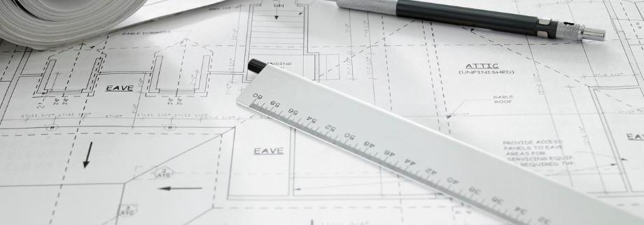
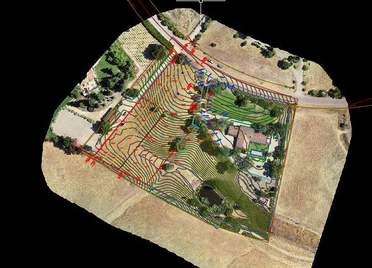
Floor Plans from Laser Scan
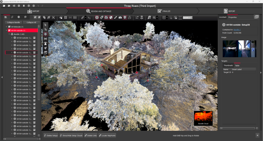
First we scan the home with our Leica BLK360 land based LiDAR scanner.
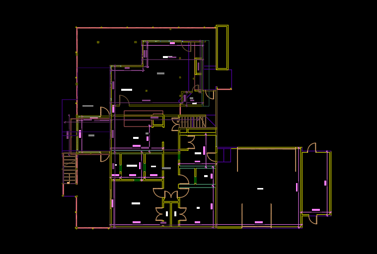
2D CAD files or Revit files from scan of single family home in Three Rivers, CA.
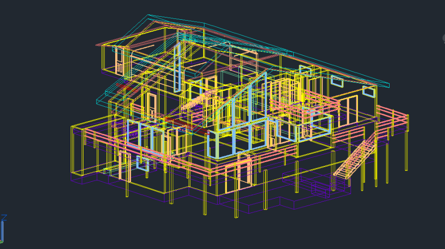
3D CAD files can be exported along with the point cloud (.las) and Revit files also. Doors, windows and the floor plan will be provided.
LiDAR Drone Mapping
Our LiDAR drone has a camera also, which means we can combine both photogrametric data and LiDAR data into one seamless topographic survey for your basemap needs! Call us for a free estimate.
Our Services
We firmly believe that only companies that concentrate their work in certain areas can provide truly exceptional work. Since we would never offer our customers anything less, we specialize in the following core competencies:
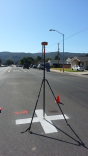
Drone Surveys! We have a DJI Phantom 4 RTK with a D-RTK 2 Mobile Station to provide you with centimeter level topographic mapping. This means we can capture most of your site with the drone, and supplement it with some on-the-ground data like the building foundation. We can also capture adjacent grades without entering onto the neighbor’s property!
Residential Construction and Surveys
Gromatici's solo-operated owner is perfect for small residential surveys, custom construction and even large muti-unit subdivision work.
Commercial and Real Estate Support
We support the construction of office buildings and shopping centers.
Transportation and Infrastructure
We provided engineering and construction support for roads, highways and utilities.
Land Development
Large subdivisions, construction support and small projects, like: Lot Line Adjustments and Parcel Mapping.
Specialties:
Topographic Survey / Mapping: Ground and Aerial
Construction Staking
Boundary Surveys
Boundary Disputes
ALTA/ACSM Surveys
Legal Descriptions
GPS Control
High-quality CAD Standards
Tentative/Subdivision Mapping
Lot Line Adjustments
FEMA Elevation Certificates
Other Services we provide:
Cell Tower Surveys
Setback Certifications
FEMA eLOMA's
BIM support
3D Survey Data
High Definition Scanning Services (Topographic Survey, Inventory Surveys)
Height Certifications (Ventura and Santa Barbara)
Gromatici provides aerial mapping services and ground control for topographic surveys. This is a cost-effective solution to large ranches and mountainous areas.
Underground Pipeline Survey
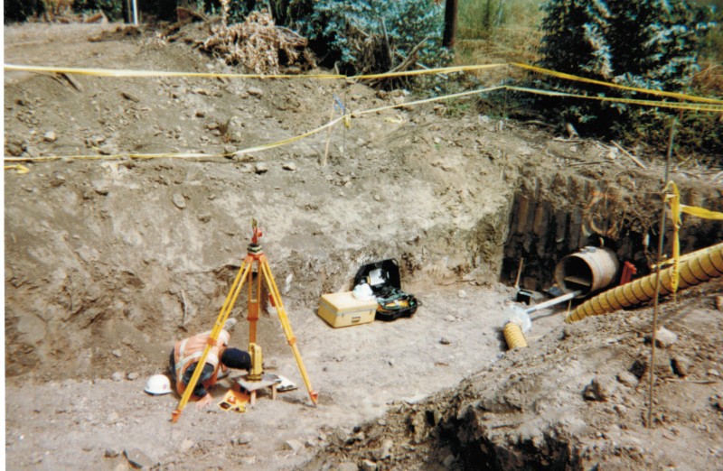
How did Eric save a contractor and client over 100,000 when he was 24?
Back in 1998 Eric was working on the layout of the Bacara Resort and Spa in Gaviota, CA. The pipeline contractor was drilling a horizontal pipeline under the 101 freeway (about 330') ran into extra hard rock half-way through the drilling. The pipe began to curve to the right due to the hardness of the rock.
In order to avoid other existing utilities, and reach their target area, the contractor decided to drill from the other side of the freeway but needed to know where to match up in the middle.
This effort would require a team effort of surveyors, engineers, welders, and the drillers. Eric, who had only been out on this project a few times, was replacing the normal crew chief that day and was tasked with finding a way to map the pipeline. The OSHA representative and the owner rep. decided against an entry to locate the 24" pipeline.
A lot was on the line, time, money, new permits...... it required some out of the box thinking and a willingness to take a risk. Eric laid out control to get in position. He spotted the right area with his compass mirror, and plumb bob. The contractor built a platform only a few inches off the ground, perfect for seeing into the darkness of the pipeline.
Eric then had the contractor build 160' of 4" PVC irrigation lines with a prism set on the end. Together we were able to survey the entire length of the underground pipeline and stake out an alignment on the other side in a matter of a few hours. No re-design, no re-engineering, and the project continued.
It's this type of problem solving and "out-of-the-box" thinking that separates Eric from the crowd.
Areas Served
Eric Ackerman is a California Licensed Land Surveyor and can survey anywhere within the state.
Gromatici serves primarily five counties: San Luis Obispo, Kern, Santa Barbara, Ventura and Los Angeles Counties.
Here are some cities and areas Eric has surveyed in:
Avila Beach, Santa Maria, Santa Margarita, Nipomo, Casmalia, Sisquoc, Isla Vista, Summerland, Faria Beach, Montecito, Morro Bay, Pismo Beach, Arroyo Grande, Oceano, Bromela, Guadalupe, Huasan, Pozo, Camarillo, Carpinteria, Gaviota, Gaviota, Glendale,Goleta, Los Angeles, Los Alamos, Los Padres National Forest, Cuyama, New Cuyama, San Luis Obispo, Paso Robles, Painted Cave, Happy Canyon, Malibu, Moorepark, Oak View, Ojai, Meiners Oaks, Mira Monte, Oak View, Casitas Springs, Wheeler Springs, Ventucopa, Pine Mountain, Oxnard, Paso Robles, Santa Barbara, Santa Ynez, Solvang, Simi Valley, Thousand Oaks, Topanga, Tujunga, Van Nuys, and Ventura, Lompoc, to list just a few.
Eric J. Ackerman, PLS is a Certified Federal Surveyor No. 1609.
Eric is licensed in California, Arizona, Idaho, Nevada, and Colorado.
CA LS 8226
AZ RLS 69068
ID PLS 18767
NV PLS 26941
CO PLS 38714
UT PLS 2201
Licensed Drone Pilot
ALTA Surveys
Elevation Certificates/ Flood
Contact Us
To contact us, just call
(805) 691-9112 or complete the
email: proposals@gromatici.com
Los Olivos: 805-691-9112
2432 Railway Ave., Suite I
Los Olivos, CA 93441
Santa Barbara: 805-845-2133
Atacadero: 805-464-2592
Current Projects
Click here to find out what projects we are currently working on.
Helpful Links
Links to research and information. Click here
Member of the Arizona Professional Land Surveyor's Association.

Member of the Santa Barbara Contractor's Association.
